New eruption has started
An eruption started this morning (February 8.) on the Reykjanes Peninsula. The eruption is located northeast of Sýlingarfell. The eruption is the sixth one in Reykjanes in the last three years.
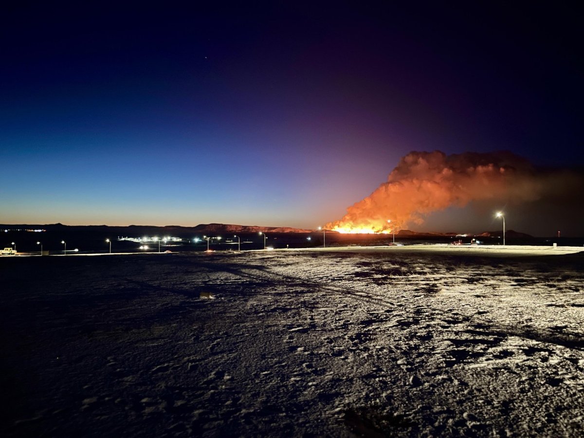
At 5:30 this morning an intense seismic activity started north-east of Mt. Sýlingarfell. Around 30 minutes later, a volcanic eruption started at the site. The eruptive fissure lengthened both towards north and south during the first minutes.

The first images from the Icelandic Coast Guard's surveillance flight suggest that the eruption is taking place at a similar location as the eruption on the 18th of December 2023. The eruptive fissure is approximately 3 km long, from Mt. Sundhnúkur in the south and stretches towards the eastern part of Mt. Stóra-Skógfell. Lava flows mostly towards the west at the moment and the flow seems to be slightly less than at the start of the 18th of December eruption.
The lava fountains reach about 50-80 m in height and the volcanic plume rises about 3 km above the eruptive fissure.
The access to the area is closed and road no. 43 towards Grindavik has been closed. Road closures can be viewed at www.road.is.
The eruption can be seen from the main road no. 41 (Reykjanesbraut), but visitors are advised not to stop the cars on the highway. Here below is a map with locations of good viewing sites.
Useful links to monitor and review updates on the events:
- The Icelandic MET office: Latest information on the seismic activity and development of events. The Icelandic Meteorological Office is observing and monitoring the eruption, analyzing developments and updating on any changes in cooperation with the Department of Civil Protection and Emergency Management, and a team of scientists from the University of Iceland.
- Iceland Ministry for Foreign Affairs: FAQ regarding flights and other info
- The Icelandic Road Administration: Information on road conditions and closures in the Reykjanes region
- Safetravel: Updates on safety
- The Icelandic National Broadcasting Service: News coverage
- Visit Reykjanes: Updates on travel information in the Reykjanes region