Why Is Reykjanes A Hotspot for Earthquakes and Eruptions?
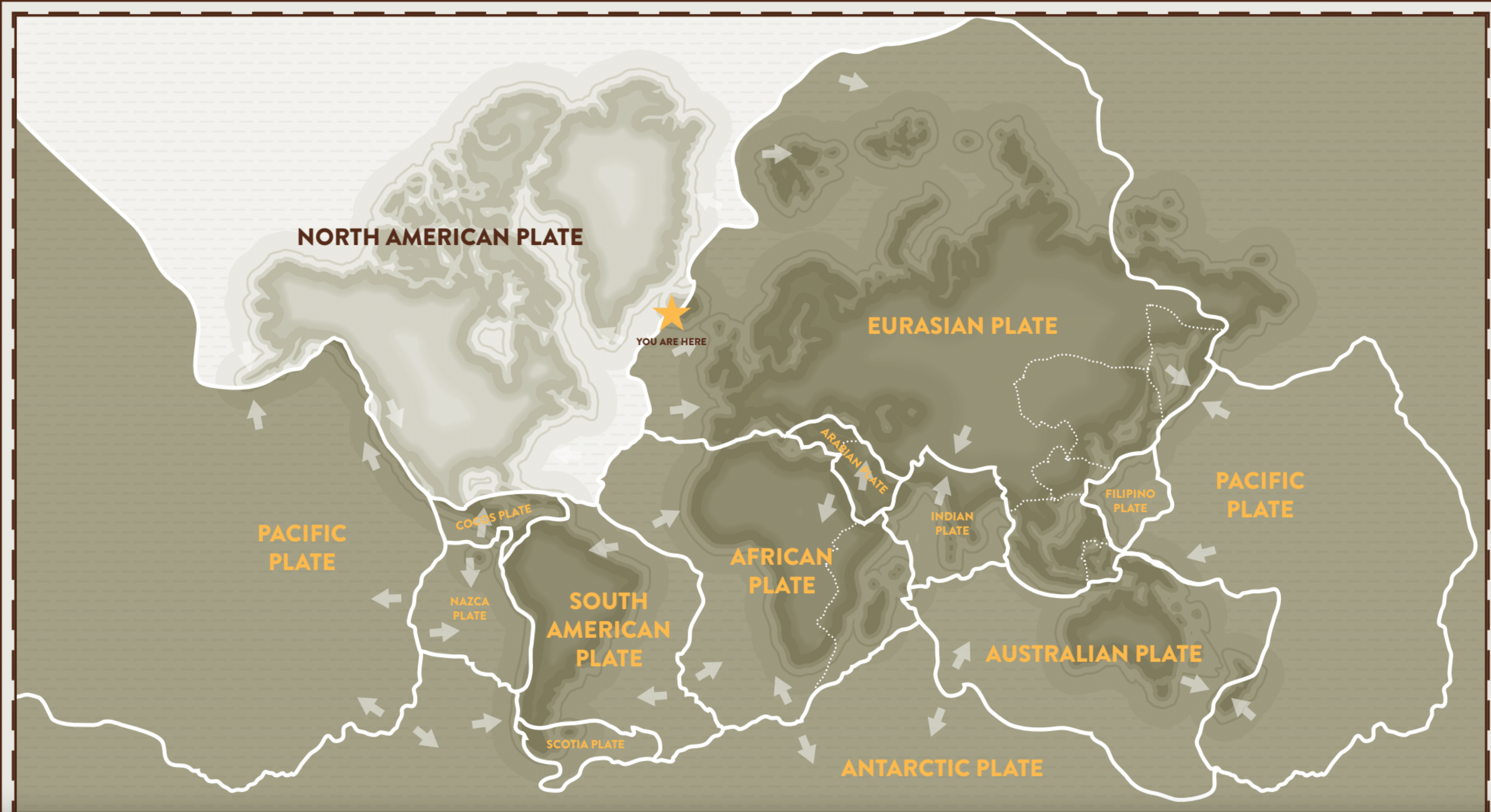
The boundaries between the North-American and Eurasian continental plates
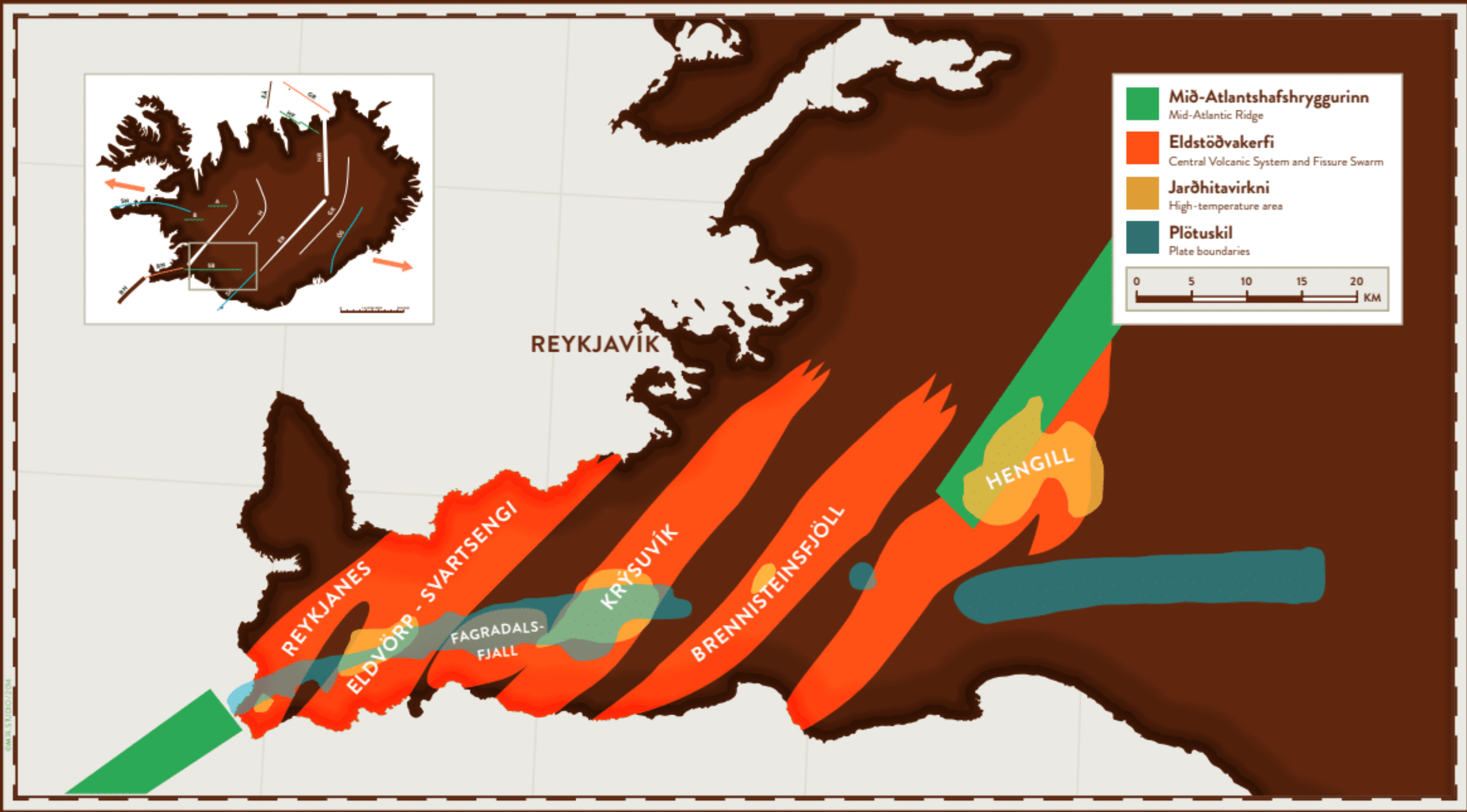
 The main reason why seismic activity and volcanic eruptions are so common on the Reykjanes peninsula is thanks to the presence of a plate boundary. It's the dividing line between two major tectonic plates running through Iceland - and across Reykjanes. These are the North American and Eurasian plates, which are moving apart at a rate of about 2 cm per year.
Along this boundary, at a belt about 10 km wide between the plates, the Earth's crust is constantly being pulled apart. This movement is uneven, so tension builds up in the crust until it literally splits, causing earthquakes. Magma from much deeper in the Earth's crust sometimes squeezes into these cracks, much like putty. When this happens, magma intrusions called dykes are created and if they manage to reach the surface, volcanic eruptions occur.
How and why Iceland is a hotspot
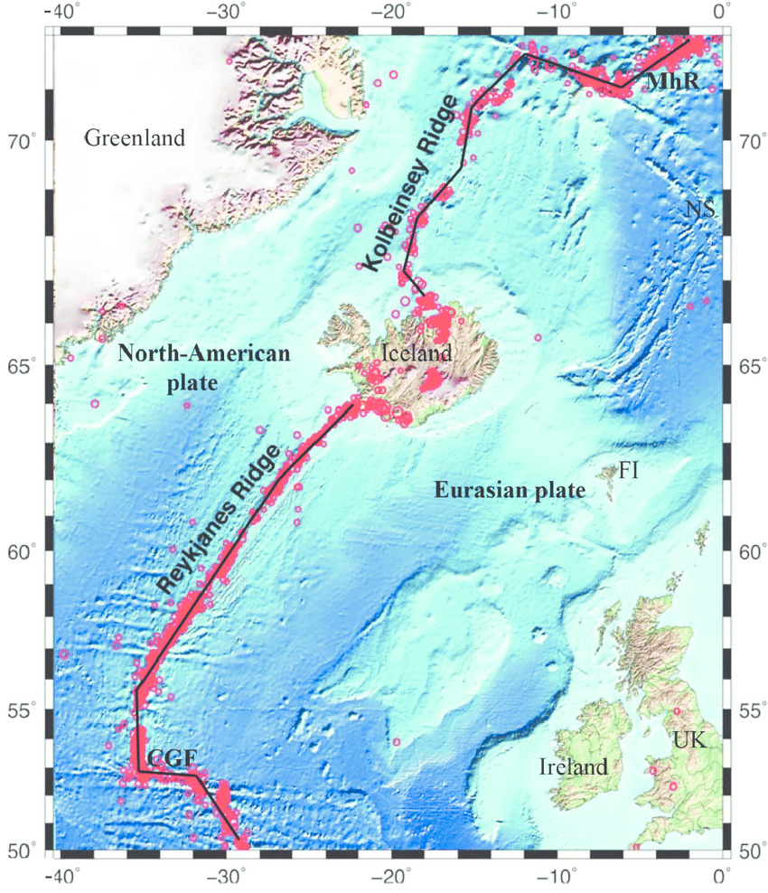
The majority of this particular plate boundary lies underwater, forming the Mid-Atlantic Ridge, except in Iceland where the boundary is on land. The reason for this is the presence of a mantle plume. Mantle plumes are found in a handful of places on the planet, and the surface areas above them are known as hotspots. Examples of other hotspots include Hawaii, the Canary Islands, and the Galapagos Islands.
Under Iceland, the mantle plume brings heat from deep within the Earth to the surface, making the crust under Iceland hotter than in the surrounding ocean. As a result, the rock is less dense under Iceland, and therefore you might say Iceland 'floats' above sea level. The mantle plume also leads to greater magma production under Iceland.
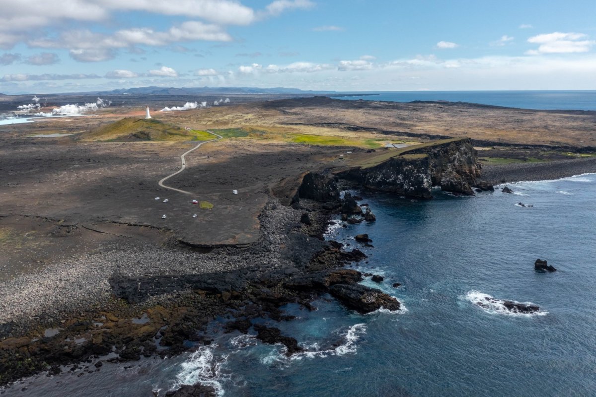
Reykjanestá: where the Mid-Atlantic Ridge meets the shore
Reykjanestá is a popular tourist destination, not only for its striking beauty but also for its geological significance. There, the Mid-Atlantic Ridge meets the shore, with a number of telltale signs you can look out for. This coastal area is characterized by noticeable fissures and rift valleys, rows of craters, lava, and tephra from previous eruptions. Icelanders call these eruptions The Reykjanes Fires, and they were a series of events that took place over the period between 1211 and 1240 AD.
Also present are impressive sea stacks, which are remnants of craters from eruptions that happened in the ocean. Another attraction is the powerful fumarole named Gunnuhver, which is fascinating to observe. Close to Reykjanestá, in Sandvík, is a site called the Bridge between Continents. This is a symbolic bridge across the plate boundary between North America and Eurasia, spanning a fissure that is actually a fault at the edge of a rift valley.
The plate boundary then extends eastward along the Reykjanes peninsula. It continues through southern Iceland and over the Central Highlands before disappearing back into the sea at Öxarfjörður in the north of the country.
In the next article, we will discuss more of the natural features on the Reykjanes peninsula that occur because of this important plate boundary.