Fara í efni

Verndum hraunið í Geldingadölum

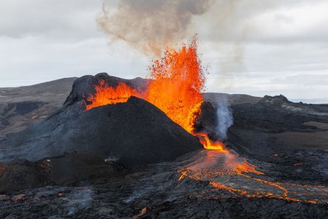
Mikið af fólki streymir að eldgosinu í Fagradalsfjalli á hverjum degi, en það er ekki allir sem ganga vel um svæðið. Við viljum minna á að sýna svæðinu virðingu og ekki skilja eftir ummerki þegar farið er að gösstöðvunum. Textinn fyrir neðan og mynd er tekinn frá Umhverfisstofnun.

Geopark Villa rising in Innri-Njarðvík

Andrea Maack is an artist and perfume designer who was fascinated by Reykjanes when she moved back home in 2015 after a long stay in Italy. Colorful geothermal areas mixed with dark and cold nature are an inspiration in her brand Andrea Maak, but also in the design of her dream house Geopark Villa. She says it is remarkable itself that Reykjanes is recognized as a Geopark and that it is just allowed to build houses so close to unique geosites. "My foreign friends see how amazing this is, but Icelanders are gradually seeing it too".

Fagradalshraun it is

Lilja Alfreðsdóttir Minister of education and culture, confirmed on 2. July a decision by the local council of Grindavík that the lava that now flows by the sites of Fagradalsfjall will be named Fagradalshraun. The direct translation is "beautiful-valley-mountain- lava -field".

Geopark Villa rís í Innri-Njarðvík

Andrea Maack myndlistakona og ilmhönnuður heillaðist af Reykjanesinu þegar hún flutti heim árið 2015 eftir dvöl á Ítalíu. Litrík háhitasvæði í bland við dökka og kalda náttúru eru henni innblástur í merkinu hennar Andrea Maack, en einnig í hönnun á draumahúsinu Geopark Villa. Hún segir það merkilegt eitt og sér að Reykjanesið sé Geopark og að það megi byggja svo nálægt einstökum jarðminjum. „Erlendu vinum mínum finnst þetta mjög merkilegt, en Íslendingar eru smátt og smátt að átta sig á þessu." Segir Andrea.

Örnefnið Fagradalshraun varð fyrir valinu

Lilja Alfreðsdóttir, mennta- og menningarmálaráðherra, staðfesti þann 2. júlí ákvörðun bæjarstjórnar Grindavíkurbæjar að það hraun sem nú rennur við Fagradalsfjall verði nefnt Fagradalshraun. 
Photo: ICEYE

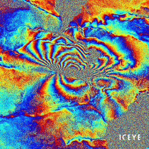
Mt. Fagradalsfjall seen from space

Many of us have seen the magnificent erupting Mt. Fagradalsfjall from ground level through a screen or even in person, but now you can see the volcano from space with the so-called Synthetic Aperture Radar (SAR) that can track flowing lava. See the development of the volcano from April. 1 - May. 6 in only 14 seconds.
Mynd: ICEYE

Fagradalsfjall séð utan úr geimnum

Öll höfum við séð stórbrotið hraunrennslið úr Fagradalsfjalli frá jörðu niðri, en nú er hægt að sjá eldgosið utan úr geimnum með svokölluðum InSAR-myndum sem greina fljótandi hraun. Sjáðu þróun eldgossins frá 1. apríl - 6. maí á aðeins 14 sekúndum.

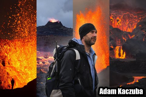
Has hiked 46 times to the eruption in Geldingadalir

The tour guide and photographer Adam Kaczuba has hiked to the volcano in Geldingadalir 46 times since the eruption started on March 19th. Before he moved to Iceland in 2006 he knew little as nothing about the country. “Having an erupting volcano almost in the backyard is beyond what I could ever imagine", says Adam.
THE U.S AIR FORCE

The erupting Mt. Fagradalsfjall that changed world history during the WWII

The erupting Mount Fagradalsfjall has changed history more than once, but ever since an American warplane crashed at the mountain during World War II it has been named “the mountain that changed world history”.

New and adventurous Volcano run

The fee collection has gone well but rainy days have caused trouble in some parking lots

Jewells Chambers explores hidden gems in Reykjanes