Skip to content

Or try searching by Category and/or Location

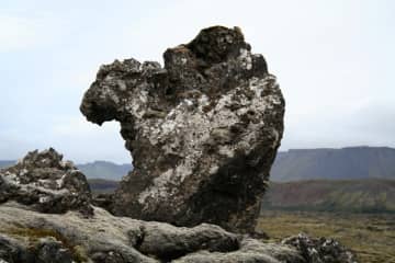
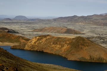
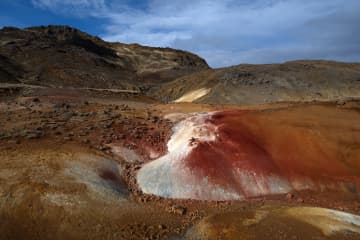
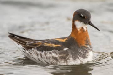
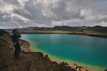
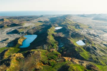
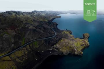
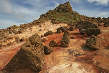
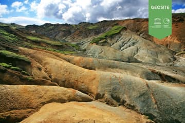
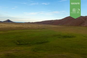
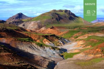
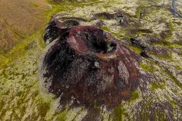
The nature reserve is about 300 square kilometres and is by far the largest region of its kind in Iceland. It is bordered in the east by the districts of Gullbringa and Árnessýsla and in the north it connects with the Bláfjöll nature reserve.


Reykjanes nature reserve

Reykjanes nature reserve

A large nature reserve ideal for recreation and to explore in the nature. The nature reserve is about 300 square kilometres and is by far the largest
Seltún

Seltún

An important high temperature geothermal area. Many study opportunities due to the great variety of features. A boardwalk leads through the area. Sel
Hraunsvík - Kleifarvatn - Birding trails

Hraunsvík - Kleifarvatn - Birding trails

Hraunsvík Hraunsvík is a bird cliff east of Grindavík. Kittiwakes and Fulmars breed on the cliff, but seabirds, ducks, and marine mammals often catch
Grænavatn

Grænavatn

Two maar type explosion craters, probably over 6000 years old. The age difference between the craters is probably small. Both of the craters are lake
Sogasel

Sogasel

Ruins of a shieling(hut), used for cattles during the summer time. The shieling was located in a crater.   Location: Short walk from road 428 (only
Djúpavatn, Spákonuvatn and Grænavatn

Djúpavatn, Spákonuvatn and Grænavatn

Three lakes in the hyaloclastite Ice Age ridges Vesturháls and Sveifluháls, contain groundwater. Djúpavatn is partly a crater lake, close to Djúpavatn
Kleifarvatn

Kleifarvatn

Lake between Sveifluháls and Vatnshlíð.  The lake Kleifarvatn is about 10 km². It is the largest of Reykjanes peninsula and the third largest of sout
Krýsuvík

Krýsuvík

Popular recreational destination with many interesing hiking paths.  Columns of steam rise skywards, bubbling mud pools play their rhythmical symphon
Geitahlid

Geitahlid

A table mountain just east of farm Krysuvik.  Geitahlíð is both a doleritie shield volcano and a table mountain. It is 386 metres high on the souther
Krýsuvík Church

Krýsuvík Church

Krýsuvík church was built in 1857 and is a typical Icelandic country church from the 19th century. The church was discontinued as a parish church in 1
Sogin

Sogin

A depression in a hyaloclastite ridge. The area is colourful due to intese high temperature alternation and a few mud pools and solfataras.  Locatio

Grænadyngja

Grænadyngja is a steep hyaloclastite mountain west of the Sog-geosite. It has the same geolocical features as Trölladyngja mountain. It is a geotherma
Vigdísarvellir

Vigdísarvellir

Ruins of the old farms Bali and Vigdísarvellir. Camping site sorrounded by beautiful scenery.  Location: Road 428 closed on winter time. 
Grænadyngja and Trolladyngja

Grænadyngja and Trolladyngja

Grænadyngja and Trölladyngja are steep hyaloclastite mountains west of the Sogin geosite. They are surrounded by young volcanic fissures, geothermal s
Stóra-Eldborg next to Geitahlíð

Stóra-Eldborg next to Geitahlíð

Eldborg is by far the highest of five craters lying along a volcanic fissure in the slopes of Geitafell, and is often called Stóra-Eldborg (Big-Eldbor