Reykjanes is the perfect area to enjoy nature and the outdoors. Here below is a list of few interesting places that are worth seeing.

Karlinn
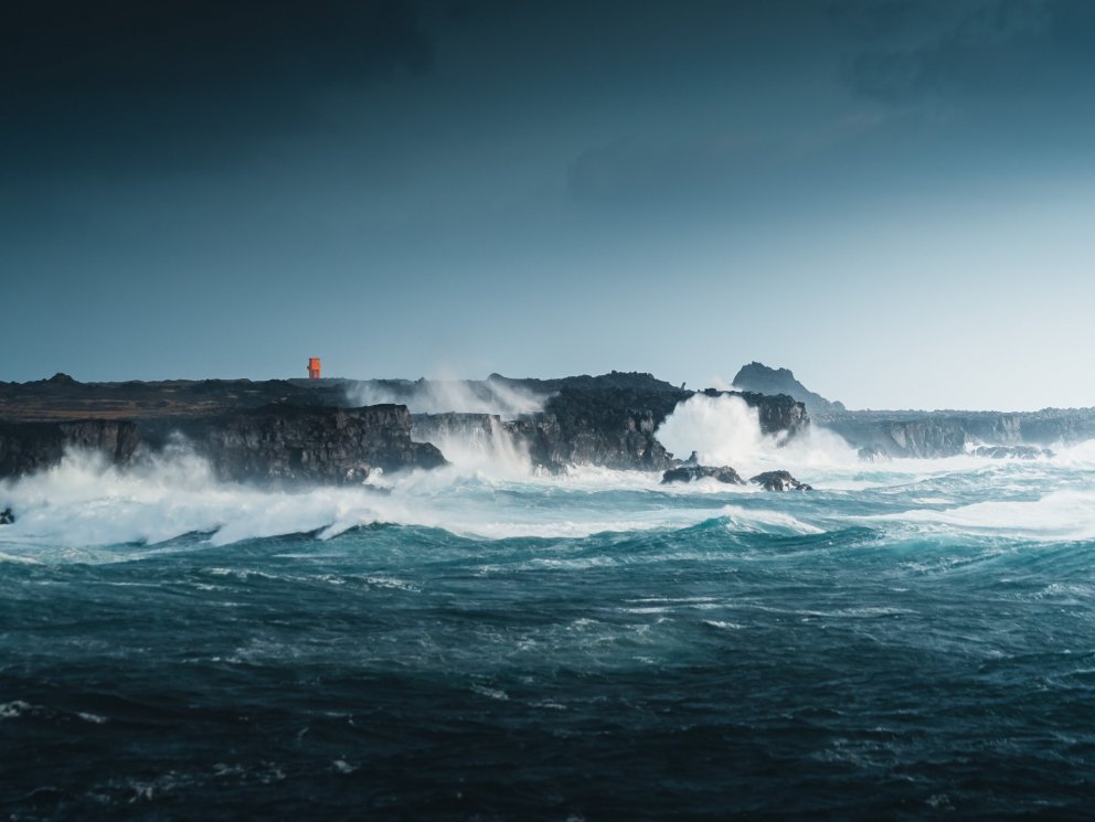
Karlinn („The Man“) is a 50-60 m high seacliff, an eroded volcanic plug, which stands high and mighty just off the coast of Valahnúkur. Karlinn is popular spot with visitors and especially among photographers, as it is truly picturesque when the unremitting waves hit the rock.
View
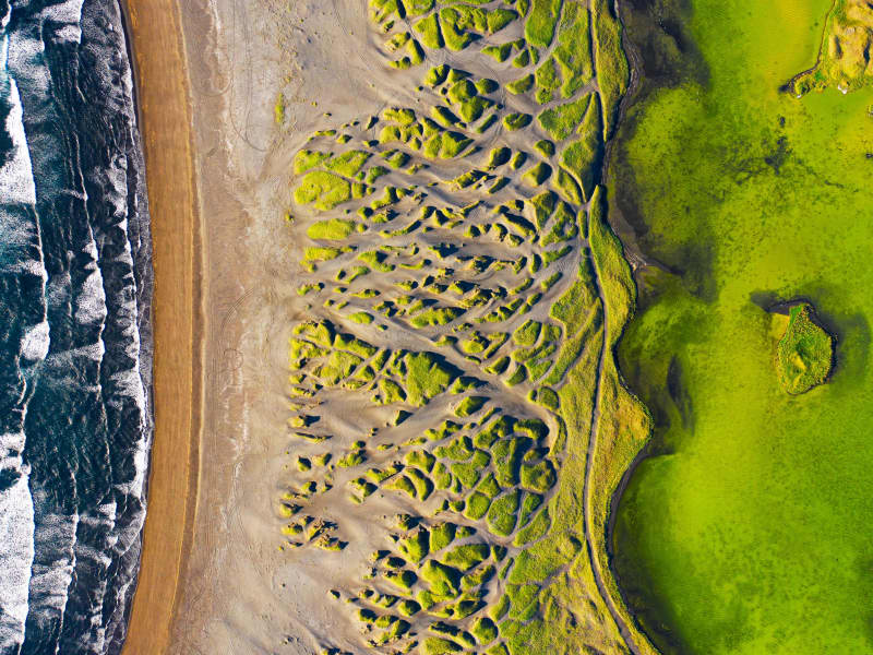
Stóra-Sandvík
Stóra-Sandvík is a beautiful cove with black sand beach and grassy dunes. Located close to Bridge between Continents, it is the perfect stop while exploring the area.
View

Brimketill
Brimketill is a small, naturally carved pool, by marine erosion, at the lava shore edge west of the town of Grindavík.
The folklore relates that the pond was regularly occupied by a giantess named Oddný. The viewing platform overlooking Brimketill is just a few steps away from the parking lot starting with a small set of stairs, making the platform inaccessible to wheelchairs. Standing on the platform you risk the possibility of getting soaked as the waves can almost reach the parking lot. Make sure to watch your step while taking in the amazing view and the unrelenting forces of nature. Utmost caution is recommended, especially when travelling with children.
The viewing platform has now been extended and gives visitors a better view over Brimketill. Safety information!
There is no safety supervision of the area.
Visitors travel at their own risk.
The waves can be unpredictable and unexpected.
Ocean currents in the area are extremely powerful.
Strong blasts of wind can be dangerous and unforeseen.
Never leave your child unattended. Hold it at all times on the viewing platform.
Entering the sea may be life-threatening.
Travel safely in Iceland. SafeTravel.is
View
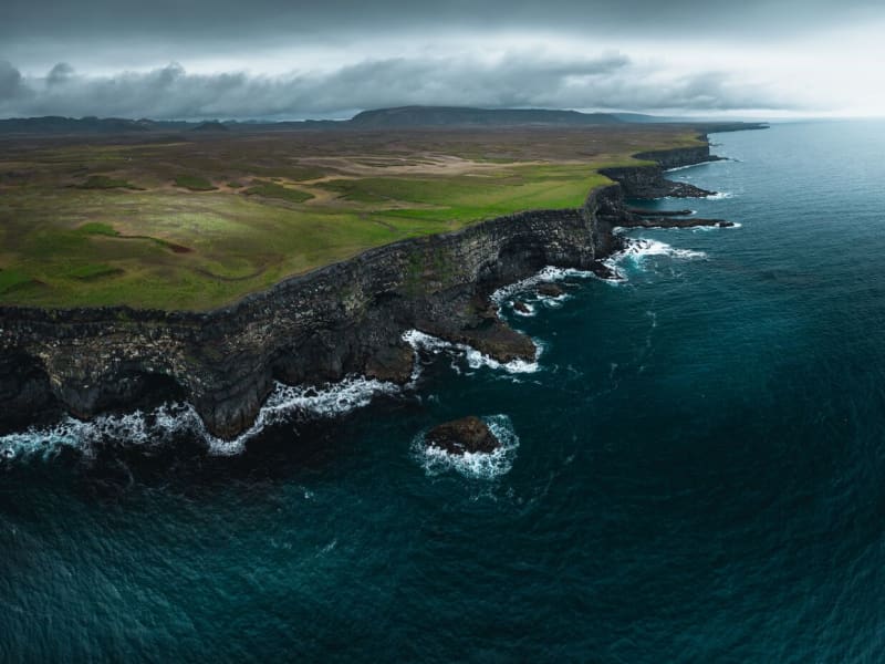
Krýsuvíkurberg
Sea cliffs with colorful birdlife.
Accessible and very interesting 15 km wide and 40 m high sea cliffs which attract over 57 thousand seabird couples every year to breed.
Location: Close to Hælsvík, walk from road 427
View
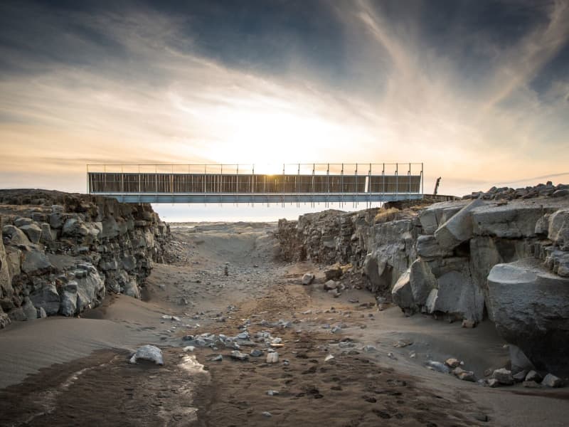
Bridge Between Continents
Note: An increase in seismic activity has been on the Reykjanes Peninsula over the last weeks. As a result, new cracks have formed—or existing ones have reopened—in several locations, including near popular sites such as the Bridge Between Continents.
These cracks can be hard to spot and may pose a danger, especially near cliffs or unmarked areas. We strongly encourage all visitors to stay on marked trails and paths and to avoid getting too close to any visible cracks or edges.
A symbolic bridge between Europe and North America on the Reykjanes Peninsula.
The lava-scarred Reykjanes peninsula lies on one of the world's major plate boundaries, the Mid-Atlantic Ridge. According to the continental drift theory, the Eurasian and North American tectonic plates are continuously drifting apart with great forces under the gaping rifts. As the plates diverge, linear fractures, known as fissures, form due to stresses created by the tension that builds up as the plates move away from each other.
The Bridge between two continents at Sandvík is a small footbridge over a major fissure, which provides clear evidence of the presence of a diverging plate margin. The bridge was built in 2002 as a symbol for the connection between Europe and North America.
One can cross the continental divide on Leif the Lucky's Bridge and take home a personalised certificate at the information center in the Folk museum in Gardur and the Reykjanes Geopark visitor center at Duus Cultural house.
View

Valahnúkamöl
High boulder ridge composed of well rounded stones.
The ridge is about 420 m long, 80 m wide and 10 m high. The rounded stones are 1-3 feet thick.
Created by powerful storms, high waves and surf.
Located: On the tip of Reykjanes, next to cliff Valahnúkur. Take road 425.
View
Festarfjall
A eroded subglacial volcano.
A section of a small hyaloclastite hill is exposed in the costal cliffs. A dyke named Festi(ladder), evidently the feeder for Festarfjall, passes up through the basement and the Festarfjall sequence, branching towards the base of the lavas. The story say that Festi is a neckless of a woman-troll.
Location: Near highway 427
View
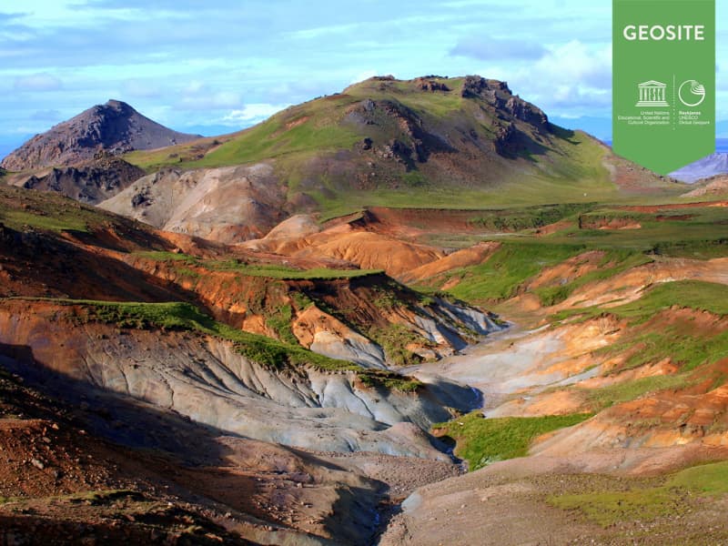
Sveifluhals
A lava flow formed in an eruption in the year 1151 AD.
In that year a 25 km long fissure opened obliquely across the Reykjanes peninsula. The lava field is located in south of ridge Nupshlidarhals(Vesturhals) and craters in the northern part are part of crater row in the north of Ridge Nupshlidarhals. Ogmundur is a male name in Iceland.
Located West of Lake Kleifarvatn. Drive road 427 and turn left on road 42 then park at Seltún and walk Preststígur. Walk estimated 2-3 hours up and down.
View

Stóra-Eldborg next to Geitahlíð
Eldborg is by far the highest of five craters lying along a volcanic fissure in the slopes of Geitafell, and is often called Stóra-Eldborg (Big-Eldborg). It is steep and made of scoria and spatter. A prominent lava channel branches off to the east. Both Stóra-Eldborg and Litla-Eldborg (Small-Eldborg) are protected. It is possible to hike up to Stóra-Eldborg, which is by many considered the most beautiful crater in the Southwest of Iceland, and from there to Litla-Eldborg where one can look straight down the crater.
Near Grindavík south of road 427 is Stóra-Eldborg and below the road is Litla-Eldborg. The path to Stóra-Eldborg was recently fixed and a new parking lot was built. New information signs will be put up this summer (2022).
View

Keilir
Keilir is a hyaloclastite mountain.
It was created during subglacial eruptions during the ice age. Its shape makes it distinctive; according to geologists, it is probably a crater plug. In spite of its steep slopes, it is not too difficult to climb, and the view from its top on a fine day is to be remembered. Keilir is the most distinctive landmark of Reykjanes and a symbol of the Reykjanes peninsula. On top of the mountain is a concrete table with a view direction map on a metal plate.
Location: 4x4 cars can drive on Höskuldarvegi and there is parking at Oddafell and a trail to Keilir.
From Höskuldarvellir there is only a 3 km walk to Keilir.
View

Kleifarvatn
Lake between Sveifluháls and Vatnshlíð.
The lake Kleifarvatn is about 10 km². It is the largest of Reykjanes peninsula and the third largest of southern Iceland. It is about 97 m deep and one of the deepest lakes in Iceland. Its catchment area is small and it has a very limited discharge on the surface. The lake has diminished since year 2000 because of two major earthquakes, which probably opened up fissures at its bottom. In the sixties char fries from Lake Hlidarvatn were released into the lake and have thrived quite well.
In the southernmost part a hot water from some hot springs runs into the lake but elsewhere the lake is very cold. A small fishing lodge is located by the lake. Great place for photographers because of the volcanic surroundings of the lake are unique and beautiful. The story says that a monster in the shape of a worm and size of a medium sized whale lives in the lake.
View

Lambafellsgjá
An open fissure in an oval hyaloclastite mount named Lambafell. The fissure is up to 50 metres deep. It is possible to hike along the entire fissure in the summer time. In the walls of the fissure are excellent outcrops of subglacially formed basaltic pillows.
Location: The walk takes about 1 hour. Take road to Höskuldarvöllur and then drive down to Trölladyngja. Park at the parking at Eldborg and walk east of Eldborg to Lambafell.
View
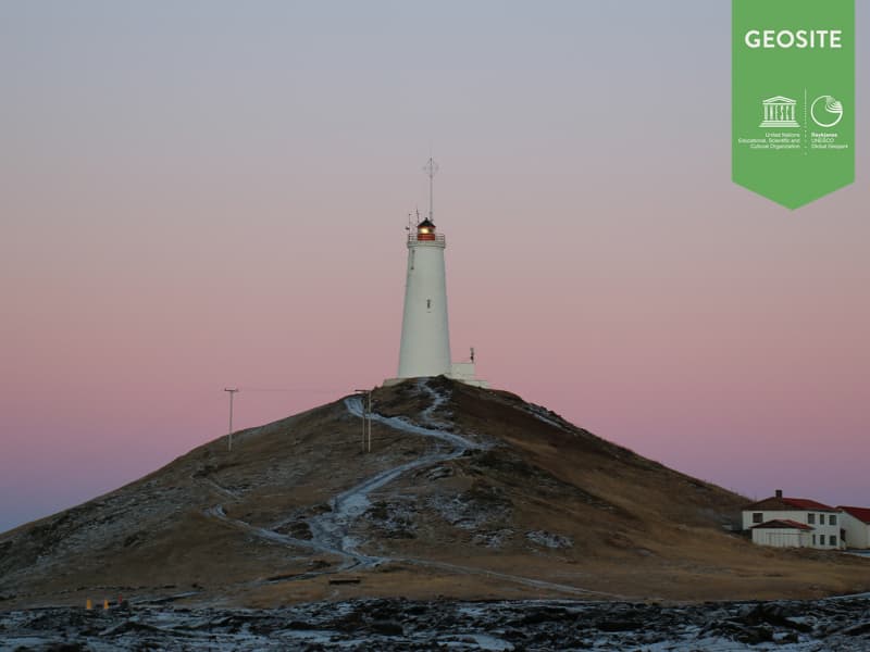
Reykjanes Lighthouse
The first lighthouse in Iceland was built on Valahnúkur in Reykjanes inthe year 1878. By 1905 earthquakes and surf had damaged Valahnúkurso much that there was the risk of the lighthouse falling into the sea.
A new lighthouse was therefore built in 1907-1908 on Bæjarfell hill in Reykjanes and the old one was demolished with an explosion on april 16th 1908. A survey which Rögnvaldur Guðmundsson supervised in 2007 for the Icelandic Maritime Administration led to the conclusion that Reykjanes lighthouse was the most popular lighthouse among Icelanders. The lightsignal height is 69 meters above sealevel but the actual height of the lighthouse is 26 metres. Reykjanes lighthouse also has a radio beacon with a correction signal. There is carved rock and concrete in the lighthouse. Architect Frederik Kjørboe and engineer Thorvald Krabbe designed the lighthouse. The operationof Reykjanes Lighthouse is under the supervision of the Icelandic Maritime Administration.
View
Snorrastaðatjarnir /Háibjalli
A popular recreational area.
Pounds, rich of vegetation and important resting place for migration birds.
Next to the pounds is Háibjalli, a 10 m high fault.
Location: Road 43 near Seltjörn and Sólbrekkuskógur.
View

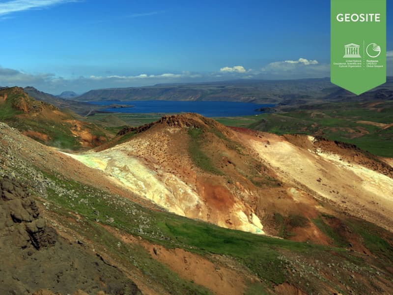
Sogin
A depression in a hyaloclastite ridge.
The area is colourful due to intese high temperature alternation and a few mud pools and solfataras.
Location: During summertime it is possible to drive on road Vígdísarvellir (428) on well-equipped cars but it is closed during winter. On winter it is possible to walk from road Krýsuvíkurvegur (42).
View
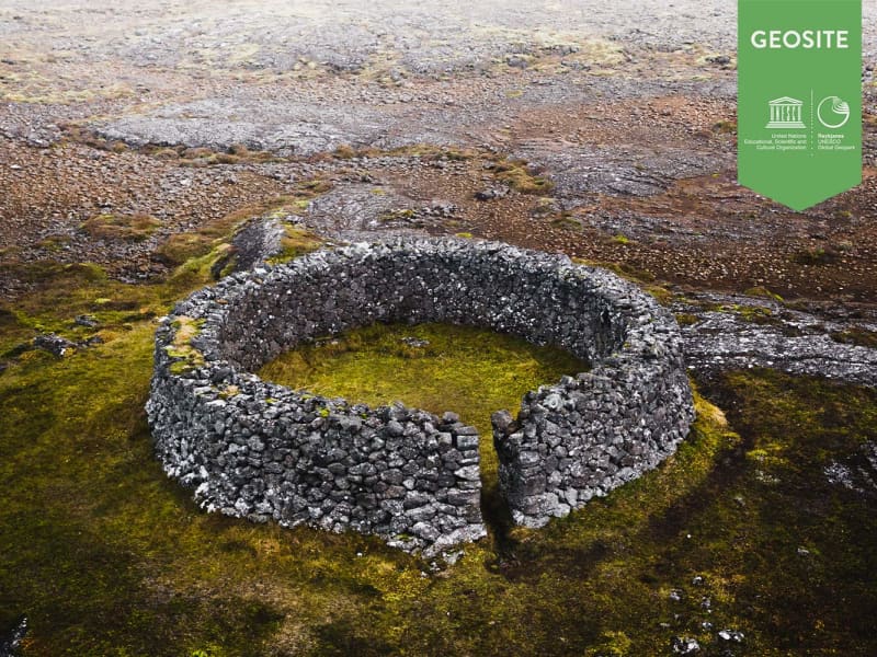
Stadarborg
A sheep shelter, round in shape and constructed skilfully from lava rocks.
Situated 2-3 km from the former parsonage Kalfatjorn in a direct line from there to Mt Dyngja.
It is about two metres high, 8 m in diameter, and 35 m in circumferance. The ground inside it is flat and covered with grass.No sources reveal its age, but it is considered to be a few centuries old. According to the legend, a man named Gudmundur built it for the reverend at Kalfatjorn. He worked elaborately at the construction, collected stones from the surrounding area to have a large selection to chose from to fit them together as perfectly as possible. He planned to close it with a cone shaped roof of stones, but the reverend envisioned it higher and more prominent than his church´s steeple and stopped the construction work. The stone mason left it exactly as we see it today. It was declared inviolate in 1951.
View
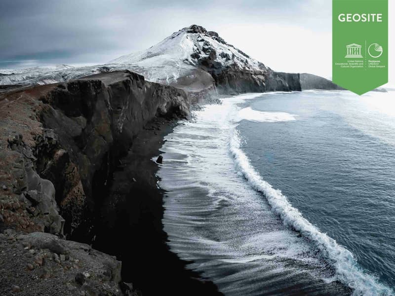
Reykjanes Unesco Global Geopark
The Mid-Atlantic ridge comes ashore on the Reykjanes peninsula.
The peninsula, with its diversity of volcanic and geothermal activity, is a Geopark and is the only place in the world where the Mid-Atlantic Ridge is visible above sea level.
The word geo is linked to the goddess Gaia, who was the personification of Earth in ancient Greek mythology. She was one of the primordial deities, the great mother of all, mother earth.
Reykjanes Geopark lies on major plate boundaries along the Mid-Atlantic Ridge, part of the 65,000km mid-ocean ridge that encircles the earth like a seam of a baseball. Although 90% of this mountain range lies deep below the surface of the ocean, it rises above sea-level right here on the Reykjanes Peninsula, making this one of the only places on earth where it is visible.
It is home to many important geological formations, some of which are utterly unique, including numerous types of volcanoes in at least four separate volcanic zones, with hundreds of open fissures and faults.
The Reykjanes Peninsula is a continuation of the Mid-Atlantic Ridge, which rises from the sea at the very tip of the peninsula and diagonally crosses Iceland from the south-west to the north-east. You can read the area’s geological history several hundred thousand years back in time, although most of the strata are less than 100–200 thousand years old. The last series of eruptions on the Reykjanes Peninsula began around AD 1000 and ended 250 years later.
The landscape that makes up the peninsula is characterized by tuff mountains and hyaloclastite ridges that formed in subglacial eruptions, as well as several series of craters and other large shield volcanoes from more recent times. In many places, there are lava stacks that formed in fissure eruptions, when large volumes of lava flowed from craters in the faults. Eruptions in Reykjanes are rarely accompanied by ash except where the volcanic fissures opened underwater or in the sea.
Earthquakes are frequent due to the spreading of the plates and occur most commonly as earthquake swarms that can last for several years. Although most of these are minor, every so often they can be felt across the entire peninsula.
Reykjanes Unesco Global Geopark is the second geopark in Iceland and the 66th member accepted into the European Geoparks Network in September 2015.
Reykjanes Geopark has listed 55 sites as Geosites. Those sites have a significant role in the Geopark and are connected to the story of the Mid Atlantic ridge and the effects of the tectonic plates.
Further information on the Reykjanes Geopark can be found on their website www.reykjanesgeopark.is.
View
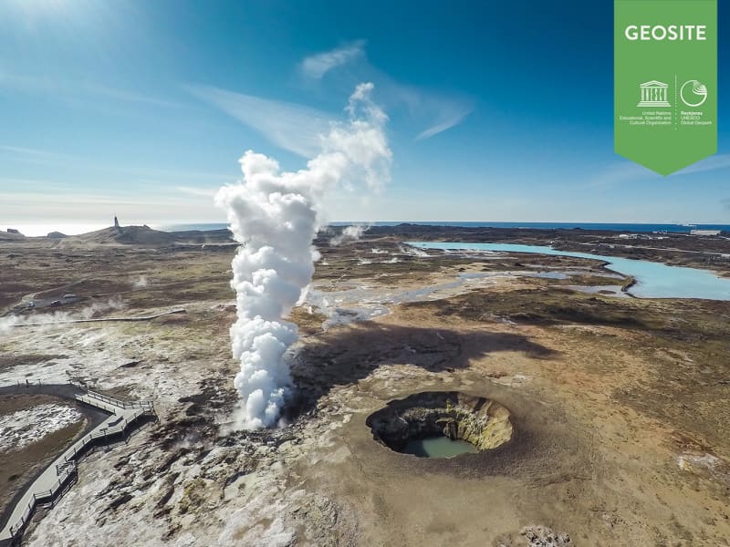
Gunnuhver
The mud pools and steam, vents in south-west Reykjanes.
The area is close to Reykjanes lighthouse and is collectively named Gunnuhver after a female ghost that was laid there. She caused great disturbance until a priest set a trap for her, and she fell into the spring about 400 years ago. Read more about her story in our blog about Gunnuhver.
The mud pools take form where steam from boiling geothermal reservoir water emanates and condenses and mixes with surface water. Accompanying gases such as carbon dioxide and hydrogen sulphide make the water acid. This causes alteration of the fresh lava rock to clay.
Steaming of the ground at Reykjanes increased markedly as a consequence of a pressure drawdown in the geothermal reservoir upon the start of production from the reservoir in 2006.
Iceland´s largest mud pool at present prominent, highest up in the Gunnuhver group. It is 20 meters wide across a rim of mud, boiling vigorously.
Two ramps are located at the Gunnuhver group, on close to Gunnuhver itself where you can look down to the spring and hear the vigorous noise, see the boiling water and feel the power bursting from the ground and the steam on your face. The other ramp is located on Kísilhól a silica hill. From there you have a good view over Gunnuhver group and surroundings.
Gunnuhver stands in the heart of the Reykjanes UNESCO Global Geopark where the North Atlantic ridge rises from the ocean, you find 100 different craters and lava fields, bird cliffs, high geothermal areas, black sand beaches, The Bridge Between Continents, geothermal power plants, lighthouses, and exhibitions.
View

Háleyjabunga
Háleyjarbunga is a small, flat lava shield with a large, 20 to 25 meter deep crater.
The shield is at least 9,000 years old. It was formed during a highly effusive lava eruption. The basalt-type is a primitive deep-mantle derived picrite that contains much of the green mineral olivine.
Location: The Háleyjarbunga is close to Reykjanes lighthouse on the tip of Reykjanes. A hikingpath is marked form Gunnuhver over the lavafield to Háleyjarbunga.
Háleyjarbunga is a geosite within Reykjanes Unesco Global Geopark.
View
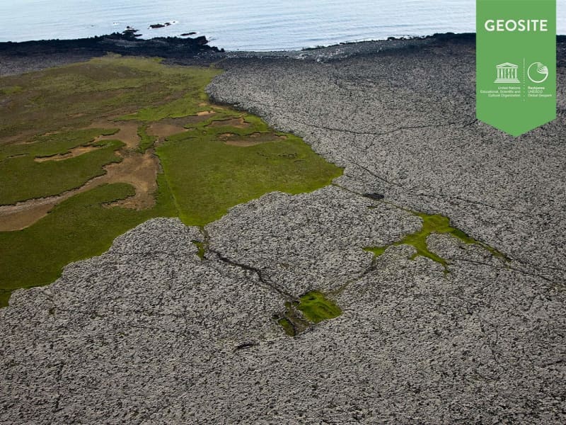
Húshólmi
Ruins of farm partly covered by lava flow.
The Húshólmi area is a so called „clearing“ over which the lava Ögmundarhraun didn´t flow during an eruption in the year 1151. The lava came flowing from vulcanic craters on the east side of Núpshlíðarháls hill down to the shore. According to archaeologists, in the western part of the „clearing“ are ruins of the ancient Krýsuvík farm, dated back since before the year 900. Among the ruins are presumably parts of a home, a church and a semetary.
Húshólmi is a popular outdoor area and a interesting site worth visiting.
View
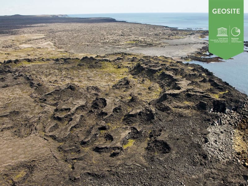
Katlahraun
Katlahraun is lava that flowed about 2,000 years ago and entered the sea. Sudden damming at the shore caused a large, circular lava pond to form. Some lava solidified, but the remaining liquid escaped. The site now contains beautiful and various lava formations.
Katlahraun is a geosite within Reykjanes Uneco Global Geopark.
View
Grænadyngja and Trolladyngja
Grænadyngja and Trölladyngja are steep hyaloclastite mountains west of the Sogin geosite. They are surrounded by young volcanic fissures, geothermal sites and beautiful colours. The two mountains are associated with various lava flows, including Afstapahraun close to the Keflavík International Airport main road.
Four kilometers on road 41 east from Mt. Keilir.
View

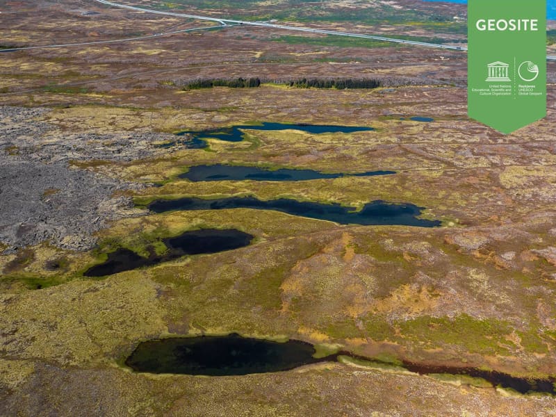
Djúpavatn, Spákonuvatn and Grænavatn
Three lakes in the hyaloclastite Ice Age ridges Vesturháls and Sveifluháls, contain groundwater. Djúpavatn is partly a crater lake, close to Djúpavatnsleið road, Spákonuvatn crater lake to the Sogin-geosite and Grænavatn to a marked path across Sveifluháls.
View

Eldvörp
Eldvörp is the name of scoria and spatter cones in off-set sections that form a row of ten kilometers, and it's surrounding lava covering 20 square kilometers. It dates back from a volcano-tectonic episode between 1210 and 1240 called the Reykjanes Fires. At the center of Eldvörp there are geothermal features and a single borehole. Women from Grindavík used to bake bread in the steam from the lava and a trail called Brauðstígur, or the Bread trail, leads there from the town. Remains of human activity can be found in various places in Eldvörp.
View
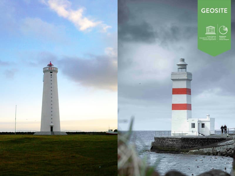
The Lighthouse on Gardskagi
On Garðskagi you can find two lighthouses, the older one and also the smaller of the two was once regarded as one of the best lighthouses in Iceland because it stood low and therefore mist was not a problem. Although there was risk of the lighthouse being damaged because of surf and it was sometimes not visible because of seastorm. A new lighthouse was built on Garðskagi in 1944. At 28 metres it is the highest lighthouse in Iceland and was in second place in a survey which Rögnvaldur Guðmundsson supervised concerning the favorite lighthouses of the Icelandic people. Engineer Axel Sveinsson designed the lighthouse but the lighthouse is a radar transponder and used for weather surveilance. The operation of thelighthouse is under the supervision of the Icelandic Maritime Administration.
View
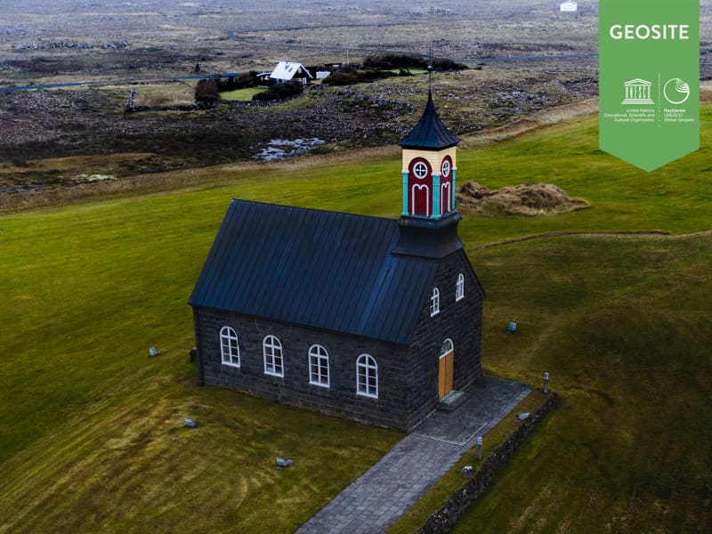
The Church at Hvalsnes
The church at Hvalsnes was consecrated in 1887. Ketill Ketilsson farmer and ship owner at Kotvogur, who then owned the land at Hvalsnes financed the building of the church. The church is preserved and is completely built of carved stone collected from the local plentiful area of rock. All of the wood in the interior was collected from the shores nearby. Extensive repairs were made to the church in 1945 under the supervision of the architect of the state. One of the most remarkable items of the church is the gravestone of Steinunn Hallgrímsdóttir who died when she was 4 years old in 1649. She was the daughter of Hallgrímur Pétursson Iceland's most important psalmist which at that time served as a priest at the parish in Hvalsnes. The gravestone was lost for a long time but was discovered again in 1964 but it had been used as a part of a walkway leading to the church.The church is still operating today and fits 100 people.
View
Brimketill
Brimketill is a small, naturally carved pool, by marine erosion, at the lava shore edge west of the town of Grindavík.
The folklore relates that the pond was regularly occupied by a giantess named Oddný. The viewing platform overlooking Brimketill is just a few steps away from the parking lot starting with a small set of stairs, making the platform inaccessible to wheelchairs. Standing on the platform you risk the possibility of getting soaked as the waves can almost reach the parking lot. Make sure to watch your step while taking in the amazing view and the unrelenting forces of nature. Utmost caution is recommended, especially when travelling with children.
The viewing platform has now been extended and gives visitors a better view over Brimketill. Safety information!
There is no safety supervision of the area.
Visitors travel at their own risk.
The waves can be unpredictable and unexpected.
Ocean currents in the area are extremely powerful.
Strong blasts of wind can be dangerous and unforeseen.
Never leave your child unattended. Hold it at all times on the viewing platform.
Entering the sea may be life-threatening.
Travel safely in Iceland. SafeTravel.is
View

Seltún
An important high temperature geothermal area.
Many study opportunities due to the great variety of features. A boardwalk leads through the area. Seltún has many mudpots and fumaroles, and minerals deposited from geothermal solutions provide colorful sediments. Good walking paths are around the area and parking.
Setún is a part of Reykjanes nature reserve.
Location: Road 42, parking, near Kleifarvatn.
View