Eruption has started on the Reykjanes peninsula
*Updated with a map of the fissure location (Dec. 19, 1 am)
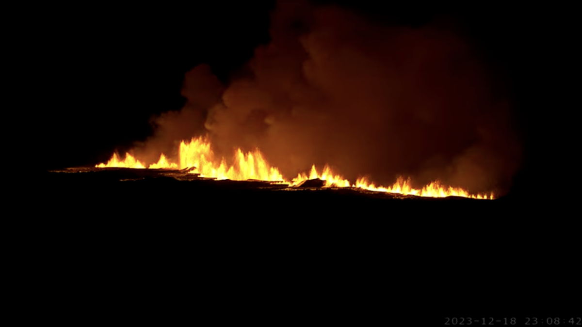
This evening, Monday, December 18th, just after 10 pm an eruption started north of Grindavik. Due to the event the Police Authorities have declared a state of emergency in the region and the Department of Civil Protection and Emergency Management is now assessing the situation with specialists from the Icelandic MET office.
Visitors are asked to stay away from the area and not to stop the vehicles on the Reykjanesbraut highway (no. 41), while the situation is being processed. As for now all roads around the area have been closed. Follow updated news on road closures on road.is.
Any updated news on the event can be found on Safetravel.is and the Icelandic MET office media.
Live feed from the eruption can be viewed on mbl.is and ruv.is
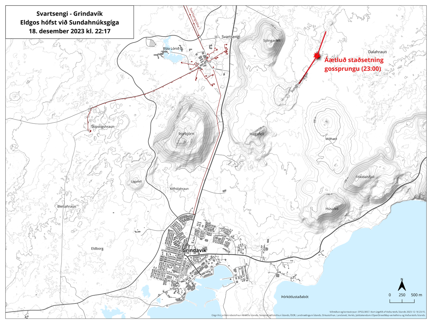
The map below shows the location of the fissure this evening (published 11 pm, 18. December 2023 by the Icelandic MET office). The red star marks the fissure.
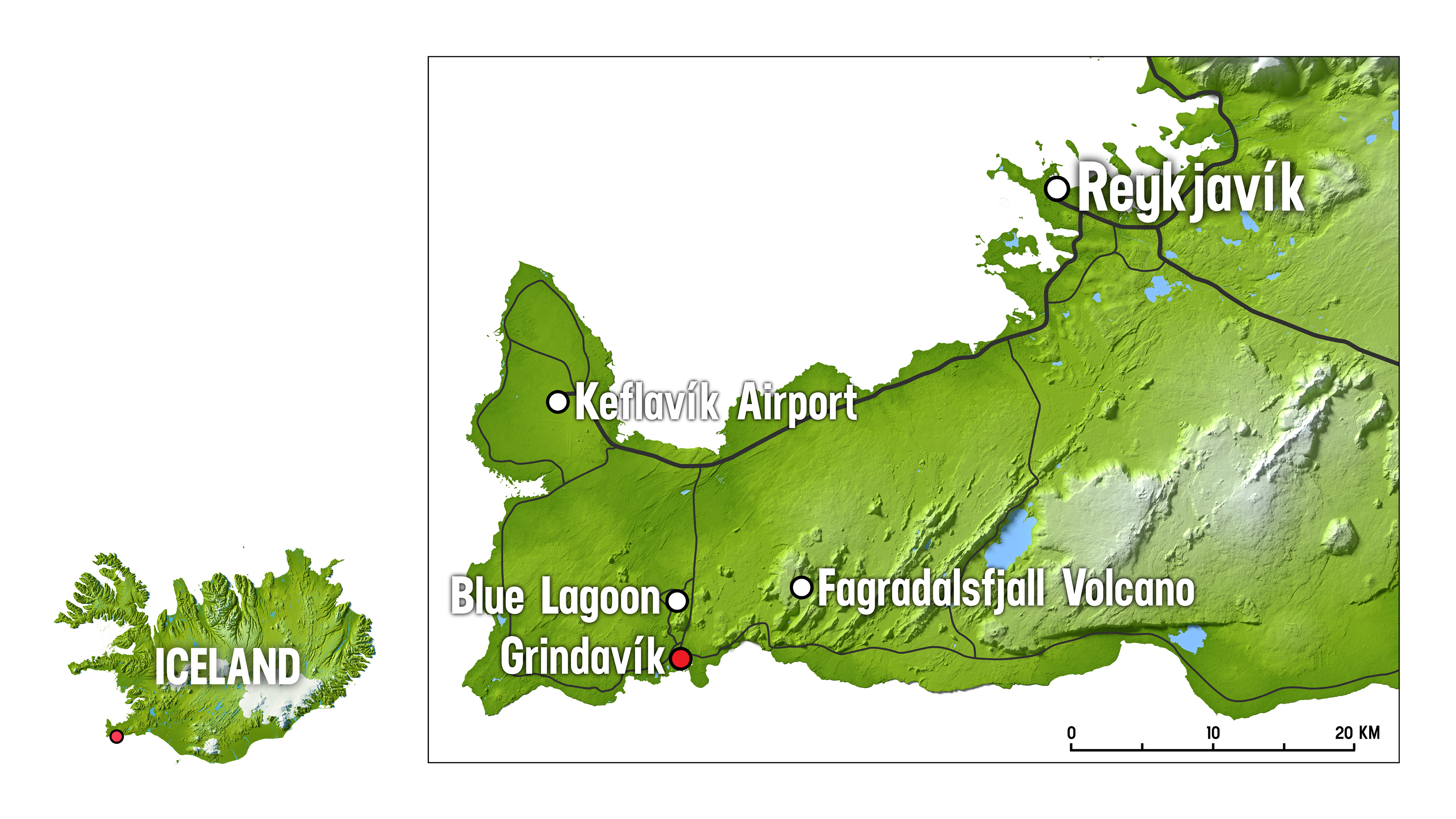
The eruption is located on the Reykjanes peninsula, west of the Fagradalsfjall volcano, marked on the map below.