All hiking trails open until 6 Pm tonight
All the hiking trails from the south of the peninsula are open (road no. 427). See map. No trails from the north are open. That includes Keilir.
All hiking trails will be closed at 6 pm today. It is being done for security reasons. Some hikers have not been respecting the hazard boundaries or following the instructions from the first responders during the night. It is not possible to manage enough security during the night. Due to that the eruption site needs to be closed during the night.
On a map, the area might look innocent and hiking trails easy. However, volcanic activity is a serious event, hiking trails are long and, the coverage of the area is bigger than hikers can imagine.
The road no 248, Vigdísarvellir, will also close at 6 pm. It is for safety reasons.
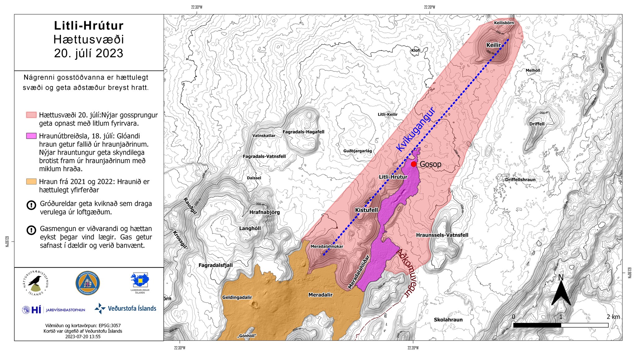
The Icelandic MET office has published an updated hazard map of the volcanic area (see below).
Hiking trails:
- The main hiking trail is the E trail - Merardalir (blue). The hike is about 18 km both ways and does not fit everyone. The hike can take up to 5-7 hours.
- Other hiking trails on the map are open.
- Hikers need to dress according to the weather, bring food and water and fully charged phones. The mobile service is not secure in the whole area.
- Before heading to the eruption site check the wind directions (the best option is the wind blowing away from the hiking trails) and news updates.
First responders:
- Police officers, first responders, and rangers are in the area for your safety.
- An ambulance is in the area.
Safety information:
- It is important to follow the instruction from the Police authorities and first responders at the site at all times. They are there to ensure your safety.
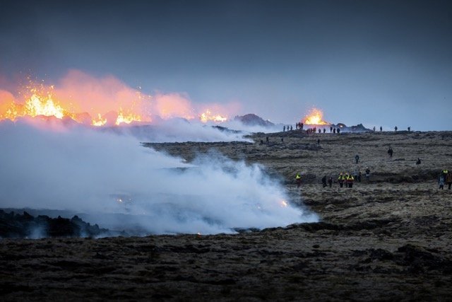
- A hazard zone has been mapped out, as the eruption site is not safe for further development of the eruption. More fissures can open in the area and the lava is still running with steaming hot lava falling on the ground around the lava flow at full speed which can be difficult to run away from. Visitors are not allowed to enter the hazard zone.
- Even though a volcanic eruption is a once-in-a-lifetime experience, it is a dangerous event and important to be alerted to any changes.
- It is not safe to go too close to the eruption site because of the volcanic gases. It becomes more dangerous with less wind.
- The volcanic gases can be life-threatening when it sets in hollow ground.
- It is recommended to use gas masks because of the wildfires.
- It is not recommended to take children to the eruption site.
- Pregnant women and people with heart or lung diseases are recommended not to go to the eruption site due to possible gas pollution and the smoke from wildfires.
- Hikers are in the area at their own risk.
Parking:
- Parking places are at the beginning of the hikes by road no. 427. See maps: PDF
- Use the marked parking places. Do not park the car on the roads.
- All driving off-road is forbidden.
Other information sites:
Gas and weather forecast: (Valid: 21. July 2023 @21:31 - 22. July 2023 @23:59)
Wind from southeast 3-8 m/s. Volcanic gases will blow to the northwest, away from the hiking trails, towards Reykjanesbær, Garður and Vogar. Older gas pollution can be seen in South and West Iceland. Later today the wind will blow from the northwest 3-8 m/s at the eruption site, and blow the gases to the southeast.
Source: The Reykjanes Police Commissioner (22. July 2023 @9:18) and the Icelandic MET office (20. July 2023)