Path E - Merardalaleið is now open
New hiking map available here.
17.07.2023
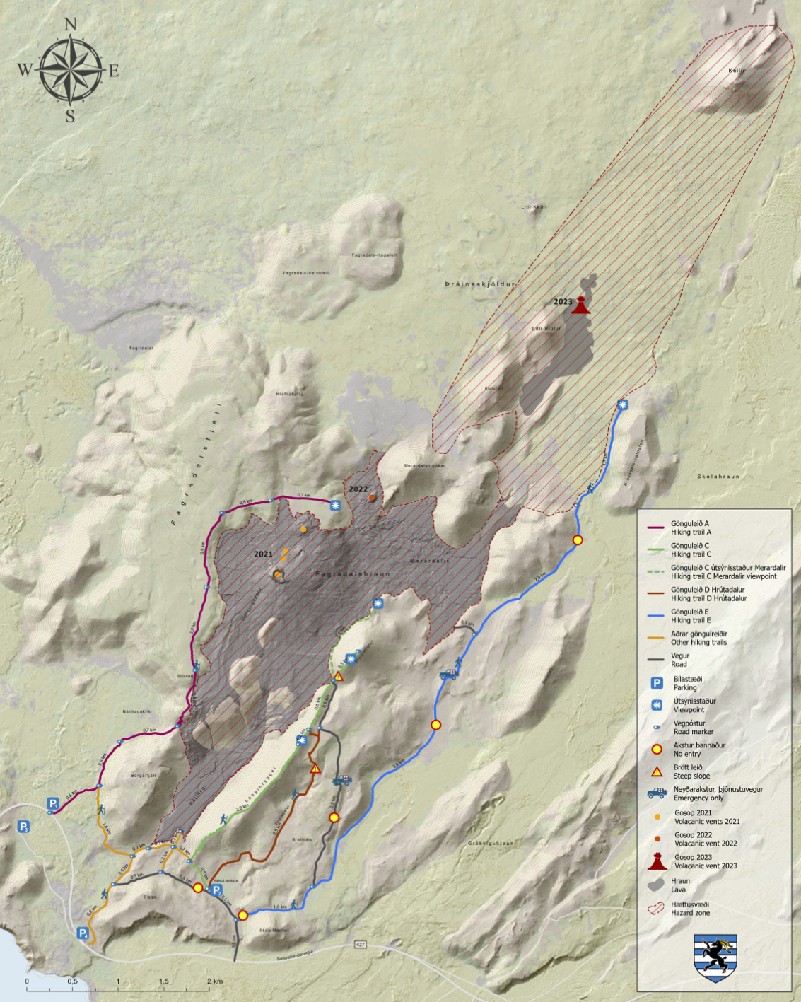
New hiking map of the area
Updated with the right path information: see news here. We are sorry for any confusion it has made.
Path E (Merardalaleið) has been opened.
Keep in mind that the eruption site is not a safe area! New erupting fissures/craters can open up anywhere without much notice.
On the attached map you can find marked paths and the hazard zone (in red). Visitors are not allowed to hike or stay in that area.
Firefighters are still at work in the area due to the wildfires and the police, SAR members and rangers are also in the area.