Skip to content

Or try searching by Category and/or Location

Hraunsvík - Kleifarvatn - Birding trails

Hraunsvík

Hraunsvík is a bird cliff east of Grindavík. Kittiwakes and Fulmars breed on the cliff, but seabirds, ducks, and marine mammals often catch prey very close to land.
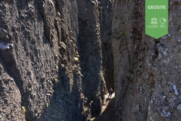
Krýsuvíkurberg

Krýsuvíkurberg is by far the biggest bird cliff on the peninsula. It is about 20 minutes’ drive east of Grindavík. The drive from the main road down to the cliff is a rough 4x4 road, but it’s worth the walk in summer time. It takes 20-30 minutes to walk the entire cliff slowly. There are approximately 21,000 Black-Legged Kittiwakes, 20,000 Common Guillemots, 2,600  Brünnich's Guillemots and 8,700 Razorbills, few Northern Fulmars, European Shags (Phalacrocorax aristotelis), puffins, Black Guillemot (Cepphus grylle),  Herring Gulls, and on top of the cliff are breeding Snow Buntings (Plectrophenax nivalis), and Purple Sandpipers (Calidris maritima).

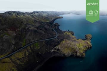
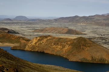
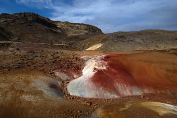
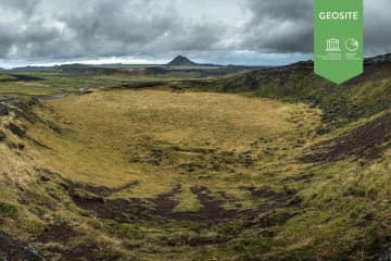
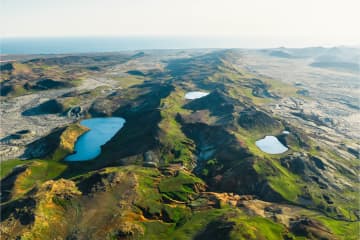
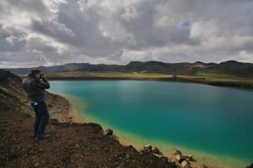
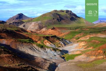
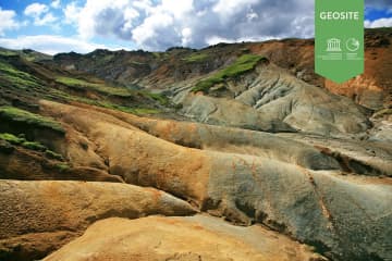
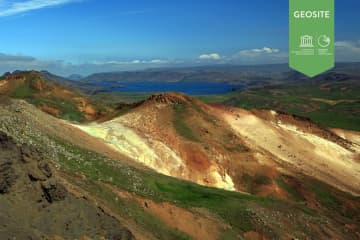
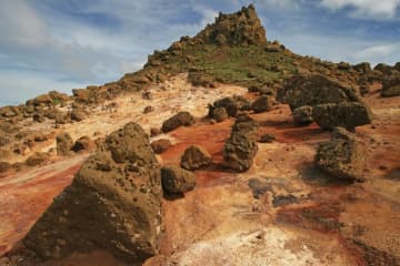
Krýsuvík and Kleifarvatn

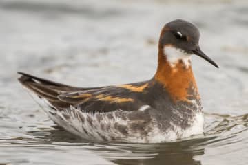
Krýsuvík is a geothermal area on the way to Reykjavík. In that area you can find a few lakes, Grænavatn, Arnarvatn, and Kleifarvatn. There you can find breeding water birds such as Great Northern Diver, Whooper Swans, Greylag Goose (Anser anser), Eurasian Teal (Anas crecca), Mallard and a few pairs of Goosander (Mergus merganser). In the fields and the mountains you can find the same meadow breeding birds that breed inland on the peninsula varying according to the vegetation: Golden Plovers, Meadow Pipits, Common Redshanks, Common Snipe (Gallinago gallinago), Whimbrels, Northern Wheatear, and occasional Black-tailed Godwit (Limosa limosa), Purple Sandpiper, Dunlin, Arctic Skua, Great Skua, and Red-necked Phalarope. 

Hraunsvík - Kleifarvatn - Birding trails

Hraunsvík - Kleifarvatn - Birding trails

Hraunsvík Hraunsvík is a bird cliff east of Grindavík. Kittiwakes and Fulmars breed on the cliff, but seabirds, ducks, and marine mammals often catch
Kleifarvatn

Kleifarvatn

Lake between Sveifluháls and Vatnshlíð.  The lake Kleifarvatn is about 10 km². It is the largest of Reykjanes peninsula and the third largest of sout
Reykjanes nature reserve

Reykjanes nature reserve

A large nature reserve ideal for recreation and to explore in the nature. The nature reserve is about 300 square kilometres and is by far the largest
Seltún

Seltún

An important high temperature geothermal area. Many study opportunities due to the great variety of features. A boardwalk leads through the area. Sel
Sogasel

Sogasel

Ruins of a shieling(hut), used for cattles during the summer time. The shieling was located in a crater.   Location: Short walk from road 428 (only
Djúpavatn, Spákonuvatn and Grænavatn

Djúpavatn, Spákonuvatn and Grænavatn

Three lakes in the hyaloclastite Ice Age ridges Vesturháls and Sveifluháls, contain groundwater. Djúpavatn is partly a crater lake, close to Djúpavatn
Grænavatn

Grænavatn

Two maar type explosion craters, probably over 6000 years old. The age difference between the craters is probably small. Both of the craters are lake
Hrútagjárdyngja (shield)

Hrútagjárdyngja (shield)

Hrútagjárdyngja is a 6,000 to 6,500 years old ava shield, plus a lava flow that covers 80-100 sq. km of land. That volume of lava is at least 3 cu. km
Grænadyngja and Trolladyngja

Grænadyngja and Trolladyngja

Grænadyngja and Trölladyngja are steep hyaloclastite mountains west of the Sogin geosite. They are surrounded by young volcanic fissures, geothermal s

Grænadyngja

Grænadyngja is a steep hyaloclastite mountain west of the Sog-geosite. It has the same geolocical features as Trölladyngja mountain. It is a geotherma
Sogin

Sogin

A depression in a hyaloclastite ridge. The area is colourful due to intese high temperature alternation and a few mud pools and solfataras.  Locatio
Lambafellsgjá

Lambafellsgjá

An open fissure in an oval hyaloclastite mount named Lambafell. The fissure is up to 50 metres deep. It is possible to hike along the entire fissure i
Eldborg at Höskuldarvellir

Eldborg at Höskuldarvellir

The grassy field Höskuldarvellir, northwest of Grænadyngja and Trölladyngja, is bordered in the northeast by a large monogenetic scoria and spatter co
Sveifluhals

Sveifluhals

A lava flow formed in an eruption in the year 1151 AD. In that year a 25 km long fissure opened obliquely across the Reykjanes peninsula. The lava fi
Geitahlid

Geitahlid

A table mountain just east of farm Krysuvik.  Geitahlíð is both a doleritie shield volcano and a table mountain. It is 386 metres high on the souther
Krýsuvík

Krýsuvík

Popular recreational destination with many interesing hiking paths.  Columns of steam rise skywards, bubbling mud pools play their rhythmical symphon