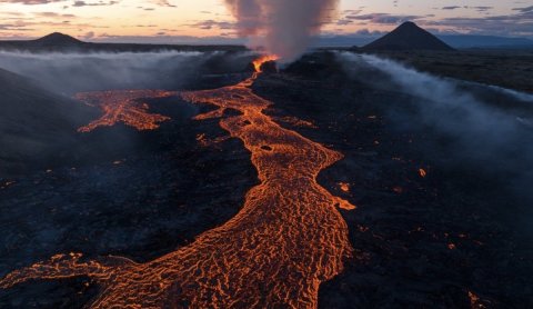
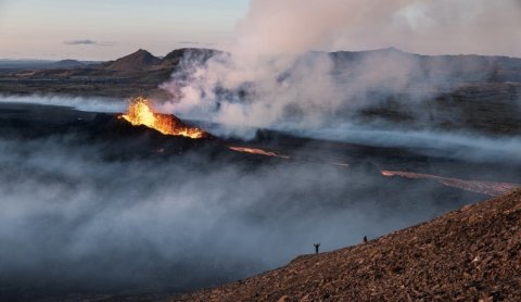
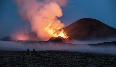
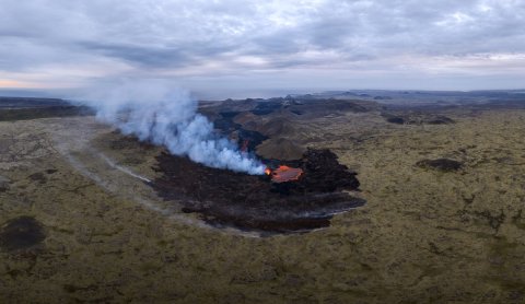
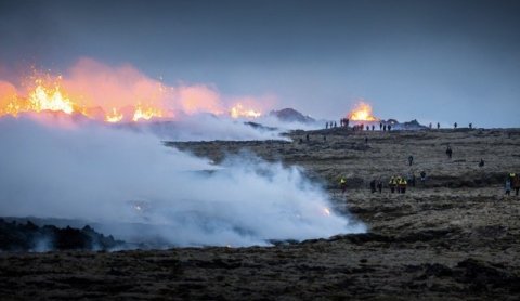
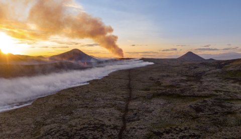
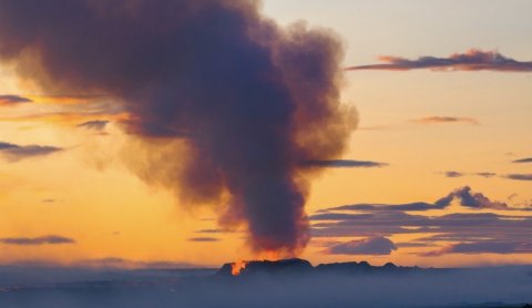
Skip to content

Or try searching by Category and/or Location

Eruption News

Updated July 11th 2023 - The Icelandic MET office

New map - hazard zone for the eruption site in Reykjanes

The Icelandic MET office published an updated map of the eruption site

The new hiking trail (D) is now open

The local authorities have opened the eruption site
A high volume of Volcanic gases and gas pollution is near the eruption site.

Gas pollution at the eruption site and a new hazard map published

Due to massive gas pollution following the eruption the site can be closed with short notice.
Location of the new eruption site compared to the Mt. Fagradalsfjall eruption site

An eruption has started on the Reykjanes peninsula

After a week of earthquakes and expected eruption, it has now started.
View from Mt. Langihryggur hiking trail (trail C). Photo: Thrainn Kolbeinsson

Visitors are encouraged to sign up for SMS alerts

Due to increased seismic activity on the Reykjanes peninsula and possible eruption, sign up for SMS alerts

Hazard map of possible eruption site in Reykjanes

A map has been published, showing the possible eruption site in Reykjanes
View to the Náttagi Valley and last eruption site. Image: H0rdur

SMS notifications sent out to visitors and residents regarding the earthquakes in Reykjanes

The Department of Civil Protection and Emergency Management, in consultation with the Reykjanes chief of police, have turned on notifications by SMS messages to visitors that enter a certain area in the region due to the earthquake swarm that started on the 4th of July.
The main crater from the eruption in 2020. Image: H0rdur

Earthquakes on the Reykjanes peninsula

Earthquakes have started again in the Reykjanes peninsula similar to the present events before the eruption in Mt. Fagradalsfjall last year. Due to that visitors are asked to take care when hiking and driving in the region, expecially close to mountain areas.
Picture from eruption site July 3rd. Picture by H0rdur

New eruption - new lava! Important information

Important information for travellers looking into hiking to the eruption site.

New eruption in Reykjanes peninsula

Today a new eruption started in Reykjanes. Travellers and visitors are asked to stay away from the area while the situation is being assessed by scientists and Authorities.
Mt. Keilir og Keilisbörn. Picture by Snorri

Earthquake swarm in Reykjanes

Travellers and hikers are asked to be aware of the risk of rock falling and landslides

New 360° aerial panorama of Fagradalsfjall Volcano (May 2022)

We recently visited the Fagradalsfjall eruption site and captured a new 360° panorama of the area. Gives you a great overview of the hiking paths, parking lots, and place names. Scroll down and interact with the map.