Due to maintenance, the road will be closed in the morning of the 13th of July between 00:00 and 06:00 (am).
New map - hazard zone for the eruption site in Reykjanes
The Icelandic MET office published an updated map of the eruption site
The new hiking trail (D) is now open
The local authorities have opened the eruption site
Gas pollution at the eruption site and a new hazard map published
Due to massive gas pollution following the eruption the site can be closed with short notice.
An eruption has started on the Reykjanes peninsula
After a week of earthquakes and expected eruption, it has now started.
Visitors are encouraged to sign up for SMS alerts
Due to increased seismic activity on the Reykjanes peninsula and possible eruption, sign up for SMS alerts
Hazard map of possible eruption site in Reykjanes
A map has been published, showing the possible eruption site in Reykjanes
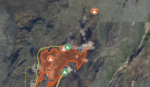
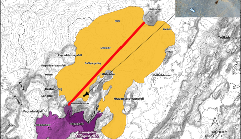
SMS notifications sent out to visitors and residents regarding the earthquakes in Reykjanes
The Department of Civil Protection and Emergency Management, in consultation with the Reykjanes chief of police, have turned on notifications by SMS messages to visitors that enter a certain area in the region due to the earthquake swarm that started on the 4th of July.
Earthquakes on the Reykjanes peninsula
Earthquakes have started again in the Reykjanes peninsula similar to the present events before the eruption in Mt. Fagradalsfjall last year. Due to that visitors are asked to take care when hiking and driving in the region, expecially close to mountain areas.
New eruption - new lava! Important information
Important information for travellers looking into hiking to the eruption site.
New eruption in Reykjanes peninsula
Today a new eruption started in Reykjanes. Travellers and visitors are asked to stay away from the area while the situation is being assessed by scientists and Authorities.
Earthquake swarm in Reykjanes
Travellers and hikers are asked to be aware of the risk of rock falling and landslides